
Cebuanos for many years before the construction of South Road Properties or SRP in Cebu the small island which was about 800 meters from the mainland and many more remember the beaches and the fishing stations on this island. Kawit island was the name of this place and even though the island is now gone its memory and history live on. Now you will read on how Kawit island came to be and how it was lost. The journey of the island from its Spanish colonial roots to today is fascinating and nostalgic for many Cebuanos. The term Kawit comes from the word hook (Cauit) which was later turned into Cawit then Kawit.

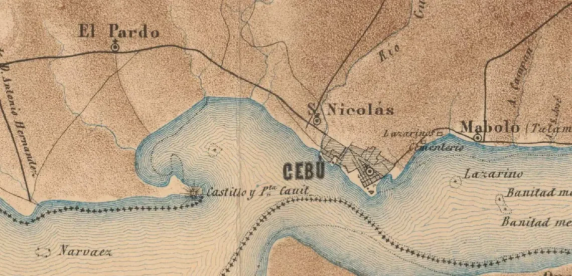
Early mentions of Kawit island can be found on a map of Cebu city from 1850. The island, now called Kawit was once a peninsula connected to mainland through a small land bridge that began south of El Pardo and would end at a point south west of San Nicolas forming a small bay. The strategic position of the island on a peninsula to the south of Cebu city would result in the construction of a small fort or Castillo. The actual fort was much smaller than even Fort San Pedro in the city, in fact most sources claim that the fort was no more than just a medium sized watchtower with a small camp below it. The small fort would only have 6 cannons and be manned by 18 watchmen, though the fort was small it was formidable as the position of the fort offered sweeping views of the bay and the strait of Cebu meaning no ship could pass without the watchful eyes of the fort monitoring. Later on the island would be mysteriously separated from mainland Cebu. The reasoning for the separation is not clear, some claim that it was the result of the theft of sand and soil from the peninsula which then only left the small island with the fort. Others claim that the peninsula was simply erased by erosion and the moving of the ocean current in the Cebu strait. Some claim that the peninsula did not exist at all and the island was the only landmass there.
The island would stay silent during the Spanish Revolution and would see new life during the American Colonization. On October 25,1904 an executive order originating from the American Colonial government in Manila possibly coming from the bureau of works or the Health ministry handed the island to the health ministry, now called the department of health. The purpose of the handover was to create a quarantine island akin to Ellis island in New York, and the reason that the island was chosen was both because of its strategic position at the mouth of the Cebu Strait but also because Kawit island with an area of 3.8 hectares was the only island large enough to support an entire quarantine zone. Quarantine zones were common because the lack of sanitation in cities during the early American period resulted in widespread epidemics of diseases like Cholera and Tuberculosis thus necessitating the need for quarantine islands to limit the spread of the diseases. Many structures were built on the island like a small hospital and 2 wards also on the island was a large water tank. The previous Spanish fort was still extant during the American period, though the watchtower was becoming unstable but it still stood with its 6 cannons. The island would be shaken as World War 2 would rock the island to its core.

As the shadow of the coming World War approached Kawit island was turned into a small camp with a equally small garrison. The quarantine facilities would become a barracks the pier that once docked with ships full of medical supplies would now dock with ships full of arms and explosives. The islands strategic position would be a determining factor again, the island was one of the first sentries to report Japanese destroyers entering the strait in 1941 and Kawit would later have a radio antenna placed on its water tower. With the fall of Bataan in Luzon the Philippines would be occupied by Japanese forces, this included Cebu. When Cebu was occupied the Japanese installed a Sea plane base here in Kawit. The water tower was again repurposed to serve the needs of the Japanese, it was turned into a large aircraft control station that would guide the seaplanes in and out of the island. There was also a small concrete watchtower built on the island to monitor the comings and going of Ships. The island would operate normally until the Liberation of Cebu in 1944-1945. The bombing campaigns meant to soften and demoralize the Japanese positions and People respectively came to Cebu and did devastating damage to the Main port area including damage to both the Cathedral and the Basilica Minore Del Santo Nino. Kawit island was not spared, like Shell island it was a strategic position meaning securing Kawit Island would go a long way to securing Cebu City, meaning some bombing sorties were concentrated on the island leading to the destruction of most facilities though the Radio control tower stayed intact. Many of the bombs dropped in 1945 did not detonate instead they buried themselves in the ground leading to many unexploded bombs that threatened the residents of the island until their removal in 2017. The total number of bombs found was 23.

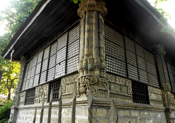
After the war the island mostly remained deserted, most people avoided the island because of the bombs that were rumored to still be on the island even after the end of World War 2. In the 1950s some bombs were recovered and with their caps removed they became part of the decorations on the island. The shells were used as walls as seen in the second picture. The health department resumed operations on the island building new structures and repairing the structures left after the war. The island remained like this for many years until the Health department decided to leave the island as quarantine islands no longer served a purpose with the advent of the vaccine and better sanitation practices. In the 1970s and 80s the island served as a swimming destination for locals of Pardo and San Nicolas who would swim the 800 meters to the island or take a boat to lounge on the island, forgetting the bombs that lied below. In 1992 during the reclamations of the Cebu government, the island became part of what would become South Road Properties (SRP) and would loose its status as an island. Kawit would loose its protected status in 2008 through a executive order declaring the land “expendable” this would result in the construction of a resort called Isla Dela Victoria which would destroy the island forever resulting in its loss to history.

The story of Kawit is one of use and disuse its current state as the property where a resort called Isla Dela Victoria will be built is sad but as time goes on people forget. Now the island is gone and the structures that were once there are lost to history, but that is the cycle of life and now progress will be made and the future for Cebu will become brighter.
UPDATE: The Nustar Resort and Casino was built on the site of Kawit Island and now occupies the space.

Very good blog?…. people are talking about this on our blog.😀 🤠
Very nice read but it could use a little editing to further polish a few parts to improve it some more.